GIS & Spatial Analysis
Transform location-based data into meaningful information for planning, research, engineering, environmental management, infrastructure and business applications.
Map · Analyze · Solve
Geospatial Intelligence | Remote Sensing | Environmental Modelling | GeoAI | Automation
GISPromo IT Solutions delivers advanced geospatial and digital solutions that transform complex spatial data into clear, actionable intelligence. We combine GIS, Earth observation, environmental and hydrological modelling, spatial analytics, automation and software technologies to help organizations understand their environments, solve complex spatial problems and make better-informed decisions.
From a single professional map to a complete geospatial modelling or decision-support workflow, we develop solutions around the problem — not simply the software.
Six connected capability areas — used individually, or combined into a single analytical workflow that runs from raw data to the decision it has to support.
Transform location-based data into meaningful information for planning, research, engineering, environmental management, infrastructure and business applications.
See change, measure change, understand change. Satellite and Earth observation data turned into information for monitoring, assessment and decision-making.
From landscapes to watersheds. Hydrological analysis, soil erosion and sediment assessment, and eco-hydrological modelling using SWAT+, InVEST and RUSLE.
Automate the repetitive, focus on the decision. Scripted, reproducible workflows in Python, ArcPy and PyQGIS, plus machine-learning-assisted spatial analysis.
Take GIS beyond the desktop with interactive Web GIS applications, spatial dashboards, ArcGIS Online solutions and decision-support systems.
More than maps. Data cleaning and transformation, Python processing, database development, automated reporting, dashboards and custom analytical tools.
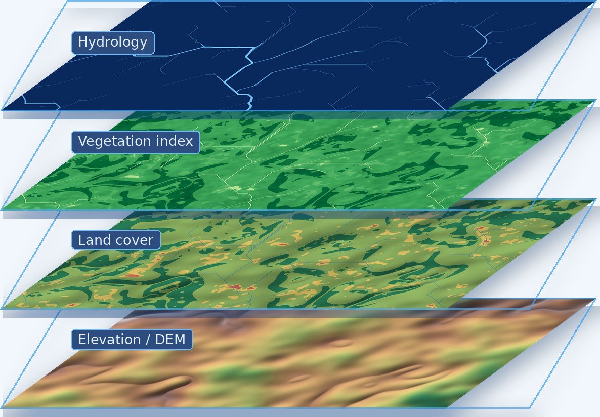
Elevation, land cover, vegetation and hydrology are not separate projects. They are views of the same catchment, and the useful answers live in how they interact — where steep ground meets bare soil above a reservoir, where a drainage line crosses a road embankment, where cover has thinned over a decade.
We build the stack once, keep every layer consistent in projection, resolution and extent, and derive the analysis from it. That is what makes a result reproducible rather than merely presentable.
A map should be the beginning of understanding — not the end of the analysis.
GIS, remote sensing, environmental science, hydrological modelling, programming and automation brought together inside a single analytical workflow.
Analytical approaches built around established geospatial and environmental methods, appropriate datasets and transparent assumptions.
Where appropriate we replace repetitive manual processing with scripted, reproducible workflows that improve consistency and efficiency.
We don't deliver complex datasets without context. Analytical results are turned into information people can understand and act on.
Projects can include documented methodologies, structured datasets, editable GIS outputs, scripts and processing workflows where required.
Every spatial problem is different. Data, methodology and technology are selected around your objective rather than forced into one workflow.
A structured six-stage process that keeps every project anchored to the decision it needs to support.
We begin with the decision or problem that needs to be addressed.
We identify the appropriate data, methodology, modelling framework and technology.
We process and analyse spatial, environmental and Earth observation data using rigorous geospatial workflows.
Outputs are reviewed through systematic quality-control procedures and, where possible, against appropriate reference information.
Complex analytical results are translated into clear maps, dashboards, reports and decision-support information.
We provide practical outputs designed for continued use — not simply presentation.
Our solutions can support organizations working across water, environment, agriculture, climate, infrastructure, planning, research and international development.
Watershed assessment, hydrological analysis, sediment modelling, catchment management and water-resource planning.
Environmental monitoring, ecosystem assessment, restoration planning, land degradation and natural-resource management.
Land suitability, crop and vegetation monitoring, terrain analysis, precision spatial analysis and agricultural resource planning.
Climate-data analysis, exposure assessment, flood and drought-related spatial analysis, vulnerability mapping and decision support.
Site analysis, terrain assessment, infrastructure mapping, asset management and spatial decision support.
Land-use analysis, accessibility, suitability assessment, development monitoring and spatial planning.
Advanced spatial analysis, reproducible analytical workflows, scientific mapping, model preparation and research support.
Geospatial and environmental analytical support for development programmes, NGOs, consulting organizations and multidisciplinary teams.
Our workflows integrate leading commercial and open-source geospatial technologies, programming environments and modelling frameworks.
Government agencies · Engineering & environmental consultants · Research institutions · Universities · NGOs · International development organizations · Businesses · Researchers · Startups · Individual professionals
We can contribute as a complete geospatial service provider, or integrate with multidisciplinary project teams that need specialized GIS, remote sensing, modelling or automation expertise.
Whether you need a professional spatial analysis, a satellite-based assessment, a watershed model, an automated GIS workflow, an environmental decision-support system or a custom geospatial application — GISPromo can help turn your data and ideas into an operational solution.
Tell us about your challenge. We'll help design the geospatial solution.